Jerusalem from the Air
Sidebar to: Church of the Apostles Found on Mt. Zion
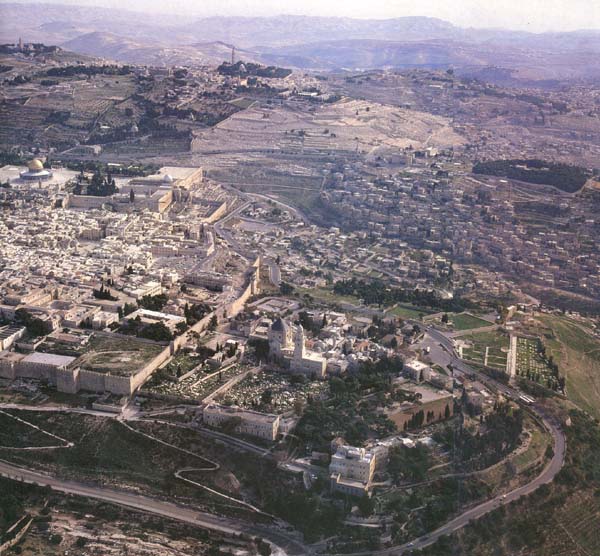
This view encompasses the oldest inhabited part of the city, plus adjacent areas to which, in the course of centuries, it expanded. Across the horizon, to the east, the barren Judean wilderness stands above the Jordan Valley and the Dead Sea, which lie in the deep, mist-filled geological rift.
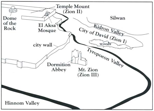
By looking with care and referring to the small drawing, we may easily discern three ridges, each referred to, at one time or other, as Zion. In this respect, Zion has been a movable mountain.
Our starting point will be Jerusalem’s most famous landmark, the golden Dome of the Rock, at far left, on the Temple Mount platform. The Temple Mount lies in the southeast corner of the Old City, enclosed by its 16th-century wall. Extending south from the southern wall are two ridges separated by a valley. The eastern ridge, or hill, was the original Mt. Zion (Zion I), which King David captured from the Jebusites in about 1000 B.C. Later, King Solomon expanded the city to the north and built his palace and the Temple to the Lord on what is today known as the Temple Mount. After that, the Temple Mount was referred to as Mt. Zion (Zion II). At the far right of the Temple Mount platform stands the silver dome of the El Aksa mosque. Immediately to its right, outside the southern wall of the Mount, the broken walls of archaeological excavations may be seen enclosed within the right angle of an asphalt road.
Already a library member? Log in here.
Institution user? Log in with your IP address.