Nineteen Bible Atlases Compared
The map illustrations with this atlas review are reproduced exactly the same size as they appear on the atlas pages. In most instances we have chosen comparable map sections so that readers may easily compare type and line quality, topographical rendering, and historical, Biblical and geographical information.
The Historical Geography of the Holy Land
By George Adam Smith (Collins: London, 1966) 512 pp., 10 black-and-white maps, no photos
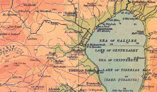
Still one of the best Biblical geographies in print, this work is also one of the earliest (first edition: 1894). George Adam Smith combined the site identification research of Edward Robinson and other early explorers with thorough descriptions of the various geographical regions that comprise the lands of the Bible. Smith’s descriptions of the land are both accurate and poetic. He did not hesitate to comment on the theological significance of Biblical historical geography. Though the maps are out of date and many of the site identifications are now known to be incorrect, the theological and literary contributions of this work are timeless.
The Westminster Historical Atlas to the Bible
Already a library member? Log in here.
Institution user? Log in with your IP address.